
 The volcanic eruption started at Sundhnúks crater row 22 August. This photo is taken one hour after the eruption started and the eruption fracture was estimated to be about 4 km long. Photo: Björn Oddsson/Civil Protection.
The last eruption was the largest in the Sundhnúkur area since December 2023
Updated 24. September at 14:00 UTC
Land uplift continues at a similar rate
Total volume of the last eruption is just over 60 million m3
Minor seismic activity at the Sundhnúkur crater row for the last few weeks
Data from GPS instruments suggest that the land uplift in Svartsengi continues at a steady rate. Model calculations based on this data also suggest that magma accumulation beneath Svarstengi has continued at a similar rate for the last weeks. According to measurements of land uplift and estimates of the rate of magma accumulation, the development is similar to previous events in the area.
The photogrammetry team of the Icelandic Institute of Natural History (IIHN) and the National Land Survey of Iceland (NLSI) has processed data collected by specialists at Efla Consulting Engineers during a drone survey over the eruption site on 11 September. The data show that the lava flow field formed in the last eruption (22 August – 5 September) was 61.2 million m3 and 15.8 km2. This makes this last eruption the largest in the Sundhnúkur area since December 2023. The thickest part of the lava flow field is located around the crater that was active the longest.
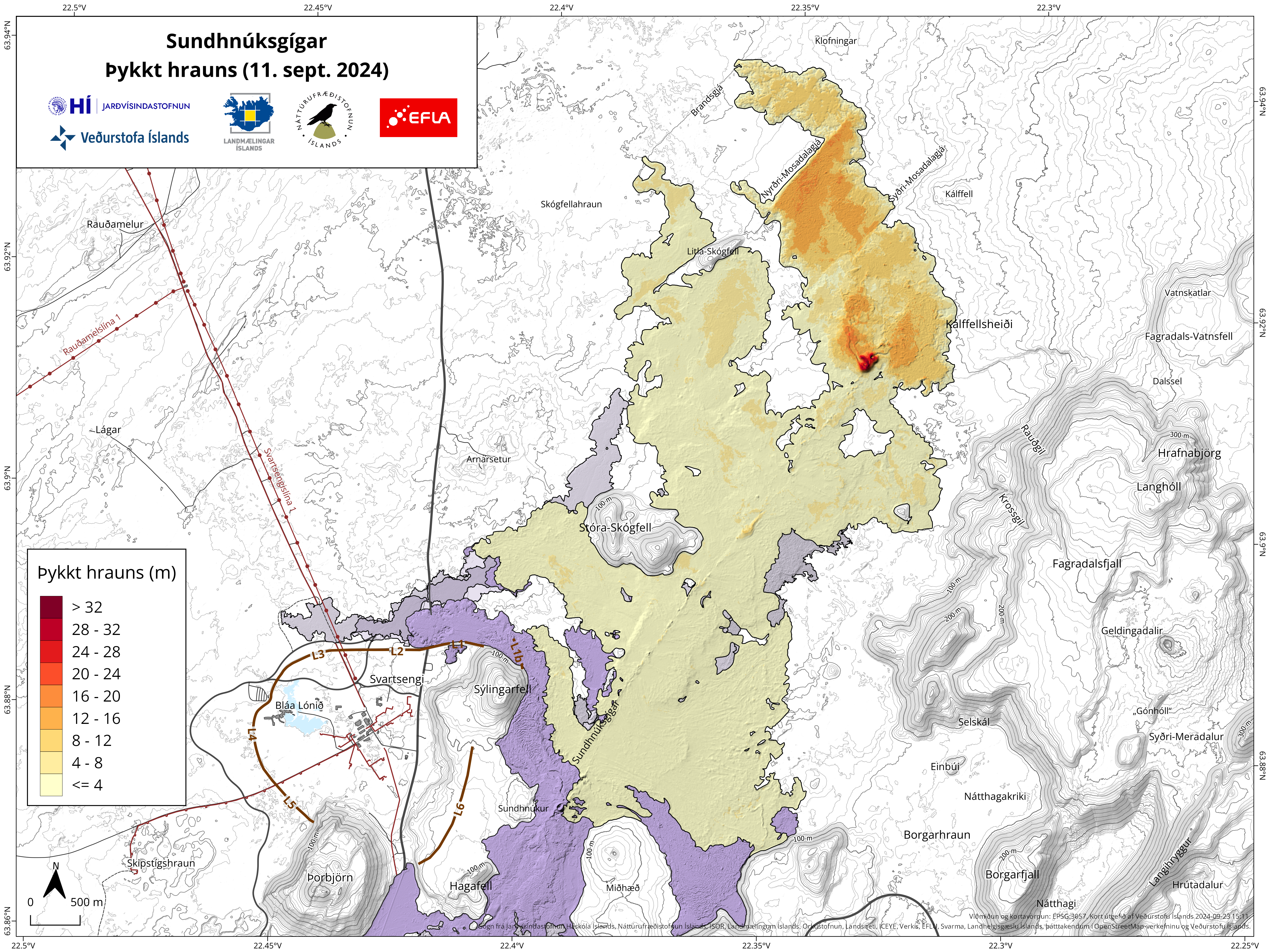 Map showing the extent and thickness of the lava flow field formed during the last eruption. The map is based on data collected by specialists at Efla Consulting Engineers which was processed by the photogrammetry team of IIHN and NLSI. Grey-colored areas show lava flow fields in the area since December 2023.
Seismic activity has been minimal for the last two weeks in the Sundhnúkur crater row. However, there has been some activity in the western part of Fagradalsfjall at a depth of about 6-8 km since the eruption ended on 5 September. There has also been considerable activity in Trölladyngja in the last few days. Most of the earthquakes in the area are small, but the largest one was of magnitude 3.0 on 22 September, just east of Trölladyngja. No deformation has been detected in the area around Trölladyngja.
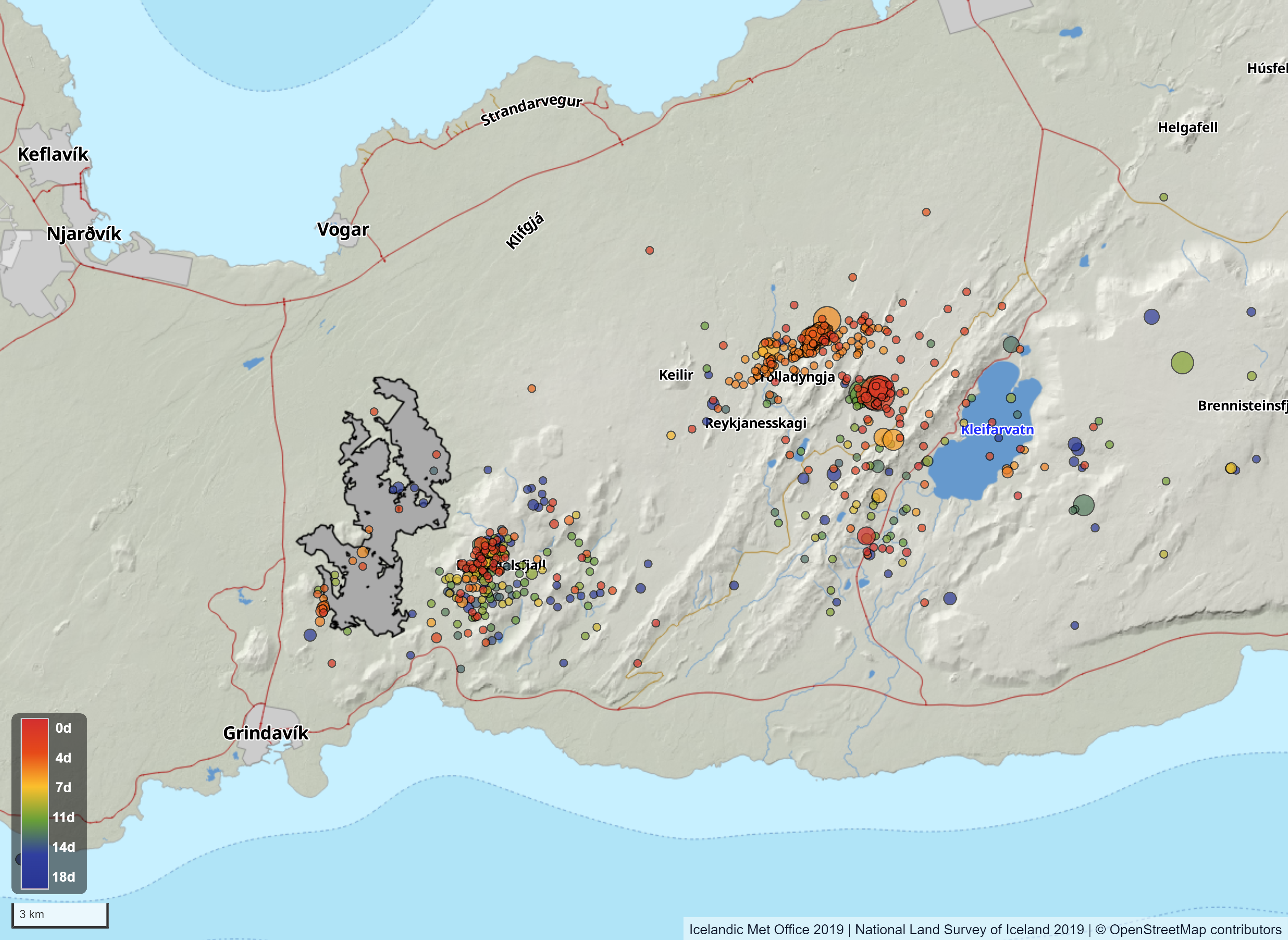 Map showing seismic activity on the Reykjanes peninsula from 6th of 24th of September. The map also shows the contours of the lava flow field that formed in the last eruption. The contours of the lava are based on data collected by specialists at Efla Consulting Engineers which was processed by the photogrammetry team of IIHN and NLSI.

Funny Tee Collections - Laugh You *ss Off and Look Damn Google While doing...
teevibeusa.com/blogs/blog/funny-tee-collection-lau…